blah blah blah
Mt. Wallingford
Length: 3.2 miles out-and-backDifficulty (click for info): Easy
Elevation Gain: 500 feet
Rating (click for info): 5/10
Elevation: 1210'
Prominence: 110'
Driving Directions:
Trailhead is on Flanders Memorial Road, in Weare, NH. Flanders Memorial Road begins on Rt. 114/77 2.8 miles north of the southern junction of Rt. 114 and Rt. 77. The trailhead is 1.3 miles down the road, on the left, marked with a Forest Society sign and a smaller wooden sign for "Mt. Wallingford Vista". You will find it just after passing a low point on the road and starting up another hill. Watch carefully, as the signs face away from the direction most visitors will be driving from. Park in the gravel lot by the gate.
Trail Map
About the Hike:
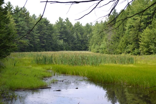
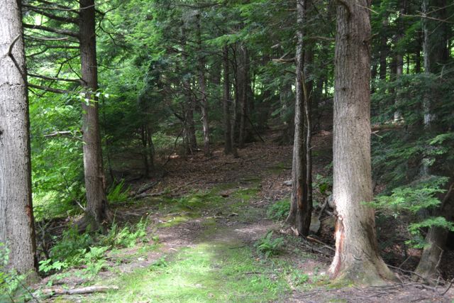
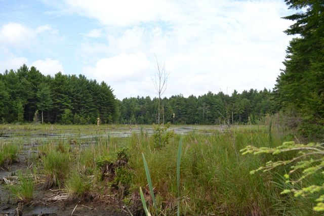
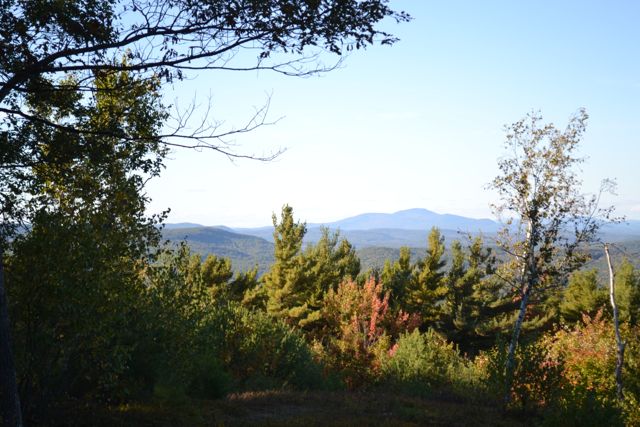
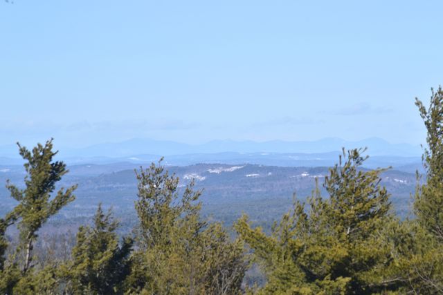
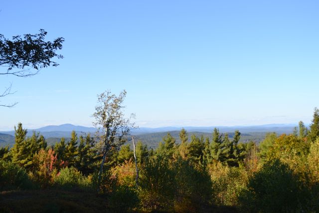
Mt. Wallingford is a small hill with a view clearing maintained by the Forest Society. The view is somewhat limited, but on clear days, the White Mountains are visible. The hike involves a pleasant forest stroll by two marshes, then a short, steep climb to the summit past recent logging. From the pull-off and Forest Society kiosk, walk past the gate through the gravel logging landing and follow the wide dirt path marked in yellow, the Mt. Wallingford Trail, into the forest. In 0.1 miles, bear left at an arrow sign and join a snowmobile trail. The trail descends gradually to a small marsh, crossing its outlet on a land bridge. It then swings to the right near a field and continues descending. In 0.6 miles from the parking area, turn right at an arrow sign and onto a footpath. The trail crosses two brooks (one with a wooden bridge), runs along a large rock, then turns and becomes flat as it parallels a long marsh. At the end of the marsh, the trail crosses another small brook and reaches a T-junction, half a mile from the snowmobile trail. Turn right and begin climbing along the side of a recently logged clearing. After a short distance up along the clearing, you will reach a "picture post", placed by the Forest Society to document change in the forest. At this point, the road which the trail has been following continues into more logging, while the Mt. Wallingford Trail turns left onto a relocation. This well-constructed, newly built trail heads into the forest away from the logging, ascending a bit, then flattening out. As you approach the bottom of a large clearcut, the trail takes a few zig-zags, then climbs a rather steep pitch, with some rocks carefully placed as steps. You will soon arrive at the top of the clearcut, where you will see another picture post, as well as a slight view over the trees. At this point, you will turn left onto the old route of the trail, which swings to the right and emerges in a large blueberry-filled view clearing. From the clearing is a good view of Mt. Kearsarge, as well as Mt. Cardigan and Ragged Mountain. If it is clear, you can see the White Mountains. The summit of Mt. Wallingford, one of the three hills tied for the highpoint of the town of Weare, is in the woods a short distance behind the clearing.
Printable directions page